
From Inwangsan, I walked along the remains/reconstruction of the old Seoul City Wall to Bukaksan, the mountain to the north of Seoul which offered the city some of its good feng shui.
Bukaksan is in Seoul’s Jongno district.
I actually had arranged to have lunch with somebody right before I left for the airport, and I knew I was definitely going to be late if I tried to go to Bukaksan. On the other hand, I knew I would probably never get another chance to see Bukaksan. So I called her, told her I was going to be late, and decided to go for it. After all, from Sukjeongmun (one of the old Joseon gates) to Changguimun (another old Joseon gate) was only 2 kilometers, so I could cover that pretty quickly, right?
What I forgot is that the name of the mountain is Buk-AK-san, and that any mountain with ‘ak’ in the name was steep/difficult to climb, like Woraksan and Seoraksan.
Ha ha ha ha ha.

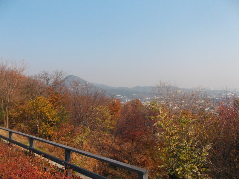
Along the way to Sukjeongmun, I saw some good views of Seoul … or at least, they would have been good without all of that haze.

I also passed by a few vegetable plots along the one. One thing I like about East Asia is, even in the richest Asian countries, people will take advantage of many convenient plots of land to grow vegetables/fruits. You can find some of them in Taipei City if you look in the right spots (hint: near Yangmingshan), and where I lived, Taoyuan city, you could find plenty of vegetable/fruit plots even in downtown. Evidently, even in hyper-dense Seoul, some people have still found some places around the edge for vegetable plots.

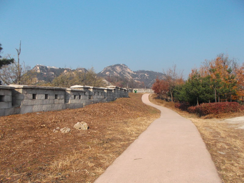
I was a little concerned about getting lost, but sure enough, by following the wall, I got to Sukjeongmun.

Even though entrance to Bukaksan is free, to enter, you have to register and give you passport number. Suffice to say, I was glad that this could be done quickly, even though a lot of people hike Bukaksan.

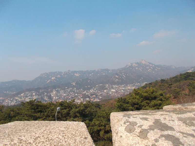
On the trail up Bukaksan, looking at Bukhansan (notice that one has an ‘h’ and ‘n’ – for a while I thought these were the same mountain because their names are so similar!)
The reason security is so tight on Bukaksan is that it is just above the ‘Blue House’ (i.e. the residence of the South Korean president), and in 1968 a team of North Korean assassins descended from Bukaksan in an attempt to kill President Park Chung-hee. More than two dozen South Korean soldiers/police officers died during the assassination attempt. The trail along Bukaksan was not reopened to the public until 2006, and even now, it is heavily monitored.

This tree has paint on the places where North Korean assassins hit it with bullets.
In addition to needed to register one’s passport number, there are guard posts all along the route, and there are strict rules about photography. Basically, taking photos looking towards the ‘Blue House’ is forbidden. All of the photos I took along the trail were approved by the nearest guard when I took the picture. It reminds me of Dongyin and Xiyin – the two most heavily fortified islands in Taiwan which are open to civilians, where I also had soldiers watching me to make sure I pointed my camera in certain directions.

It was steep (it does have ‘ak’ in the name), so my progress was a lot slower than expected. On the other hand, I got good views over Seoul from a very different angle than what I saw at Namsan.

Eventually, I got to the highest point of the trail, and going downhill was much easier.

I then got to Changuimun, and then I had to figure out how to get to the meeting I had set up (I was already way late).

Changuimun, the gate where I exited
Just as I was trying to figure out what my public transit options were, a taxi just happened to pass by. Since I was leaving South Korea that day, I didn’t have much need for my leftover won anyway, so I didn’t hesitate to get a ride to Anguk subway station. From there, I took a train to Chungmuro Station, and then another train to Isu station, and finally a third train to Namseong station (it was annoying to make two different train transfers even when I wasn’t late for a meeting).

In the next post I will describe my meeting, and then my departure from South Korea.

Pingback: A Final Afternoon in South Korea: The Meeting, the Guesthouse, the Airport | S.K. in S.K.
Pingback: SK in SK: Chronological Order | S.K. in S.K.
Pingback: SK in SK: A History of South Korea | S.K. in S.K.
Pingback: SK in SK: Climates of South Korea | S.K. in S.K.
Pingback: SK in SK: South Korea & Other Countries | S.K. in S.K.
Pingback: SK in SK: The Landscape of Feelings | S.K. in S.K.
Pingback: SK in SK: Discovery vs. Construction | S.K. in S.K.
Reblogged this on CENGIZ TASKIN'S PAGE (ALL WELCOME) and commented:
A Fine Place To Go Indeed!! 😤☺️
LikeLike